

Preview
Flight Code
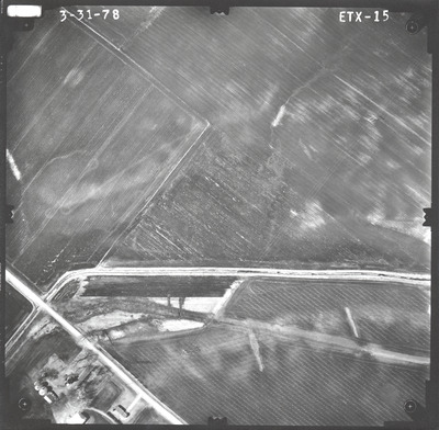
ETX
Date Flown
Spring 3-31-1978
Aerial Survey Project No. (A.S.P. No.)
78S-27
County
Blue Earth
Trunk Highway (T.H.)
22
Location
Bridge 4768, 1 mi. N. of Mankato
Center Latitude
44°12'35.56"N
Center Longitude
93°57'10.47"W
Scale
1''=250'
Flight Height
1500
Work Order No.
132
Agreement No.
58318
State Project No.
0714
Focal Length
152.465 mm
Physical Format
Black and White Physical Aerial Photograph
Dimensions
9 x 9
Item Type
Still Image
Collection Name
Minnesota Department of Transportation District 7 Air Photo Collection, 1957-2006
Contributing Organization
Dr. Mary T. Dooley Map Library, Memorial Library, Minnesota State University, Mankato, P.O. Box 8419, Mankato, MN 56002-8419
Contact Information
Dr. Mary T. Dooley Map Library, Memorial Library, Minnesota State University, Mankato, P.O. Box 8419, Mankato, MN 56002-8419
Creative Commons License

This work is licensed under a Creative Commons Attribution-NonCommercial 4.0 International License
Scanning Center
Dr. Mary T. Dooley Map Library, Memorial Library, Minnesota State University, Mankato, P.O. Box 8419, Mankato, MN 56002-8419
Object File Name
MnDOT_1978_78S-27_ETX-15.tif
Date Digital
2022-07-21
Item Digital Format
Image/tiff
Master File Format
Image/tiff
Master File Size
104112090
Master File Bit Depth
24
Master File Resolution
800 dpi
Master File Width
7621
Master File Height
7475
Master File Hardware
Epson Expression 10000XL
Master File Software
VueScan
Master File System
Windows 10
Master File Checksum
28b8c091fba70ff18a495b29965e8149
Keywords
mndot, air photos, aerial photography, 1978, stream, field tiling

