

Preview
Flight Code
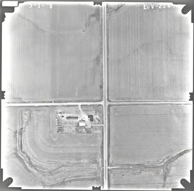
EUV
Date Flown
Spring 5-1-1978
Aerial Survey Project No. (A.S.P. No.)
78S-34
County
Rock
Trunk Highway (T.H.)
75
Location
From Iowa Line to Luverne
Center Latitude
43°34'23.54"N
Center Longitude
96°12'47.80"W
Scale
1''=250'
Flight Height
1500
Work Order No.
132
Agreement No.
58318
State Project No.
6704
Focal Length
152.46 mm
Physical Format
Black and White Physical Aerial Photograph
Dimensions
9 x 9
Item Type
Still Image
Collection Name
Minnesota Department of Transportation District 7 Air Photo Collection, 1957-2006
Contributing Organization
Dr. Mary T. Dooley Map Library, Memorial Library, Minnesota State University, Mankato, P.O. Box 8419, Mankato, MN 56002-8419
Contact Information
Dr. Mary T. Dooley Map Library, Memorial Library, Minnesota State University, Mankato, P.O. Box 8419, Mankato, MN 56002-8419
Creative Commons License

This work is licensed under a Creative Commons Attribution-NonCommercial 4.0 International License
Scanning Center
Dr. Mary T. Dooley Map Library, Memorial Library, Minnesota State University, Mankato, P.O. Box 8419, Mankato, MN 56002-8419
Object File Name
MnDOT_1978_78S-34_EUV-224.tif
Date Digital
2022-08-05
Item Digital Format
Image/tiff
Master File Format
Image/tiff
Master File Size
92088948
Master File Bit Depth
24
Master File Resolution
800 dpi
Master File Width
7477
Master File Height
7363
Master File Hardware
Epson Expression 10000XL
Master File Software
VueScan
Master File System
Windows 10
Master File Checksum
869555a515baa9dbd04032b8493fb7b2
Keywords
mndot, air photos, aerial photography, 1978, stream

