

Preview
Flight Code
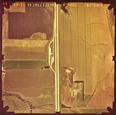
FNC-CN
Date Flown
Fall 10-14-1979
Aerial Survey Project No. (A.S.P. No.)
79F-5
County
Nobles
Trunk Highway (T.H.)
I-90, 60
Location
Rest Areas along I-90 and on TH 60 E. of St. James
Center Latitude
43°38'14.11"N
Center Longitude
95°58'42.89"W
Scale
1''=500'
Flight Height
3000
Notes
Note on back reads "Adrian East Bound."
Work Order No.
12
Agreement No.
59680
Lens Serial Number
124302
Focal Length
152.96 mm
Physical Format
Color Physical Aerial Photograph
Dimensions
9 x 9
Item Type
Still Image
Collection Name
Minnesota Department of Transportation District 7 Air Photo Collection, 1957-2006
Contributing Organization
Dr. Mary T. Dooley Map Library, Memorial Library, Minnesota State University, Mankato, P.O. Box 8419, Mankato, MN 56002-8419
Contact Information
Dr. Mary T. Dooley Map Library, Memorial Library, Minnesota State University, Mankato, P.O. Box 8419, Mankato, MN 56002-8419
Creative Commons License

This work is licensed under a Creative Commons Attribution-NonCommercial 4.0 International License
Scanning Center
Dr. Mary T. Dooley Map Library, Memorial Library, Minnesota State University, Mankato, P.O. Box 8419, Mankato, MN 56002-8419
Object File Name
MnDOT_1979_79F-5_FNC-CN-4.tif
Date Digital
2022-08-12
Item Digital Format
Image/tiff
Master File Format
Image/tiff
Master File Size
104937052
Master File Bit Depth
24
Master File Resolution
800 dpi
Master File Width
7616
Master File Height
7502
Master File Hardware
Epson Expression 10000XL
Master File Software
VueScan
Master File System
Windows 10
Master File Checksum
90ad3d46753c0596047031a73679f54b
Keywords
mndot, air photos, aerial photography, 1979, kanaranzi creek, stream, marsh

