

Preview
Flight Code
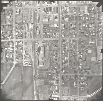
FGK
Date Flown
Spring 4-17-1979
Aerial Survey Project No. (A.S.P. No.)
79S-10
County
Waseca
Trunk Highway (T.H.)
14
Location
Smith [Smiths] Mill to Janesville
Center Latitude
44° 6'56.66"N
Center Longitude
93°42'13.09"W
Scale
1''=250'
Flight Height
1500
Work Order No.
44
Agreement No.
59194
State Project No.
8103-25
Lens Serial Number
98183
Focal Length
152.46 mm
Physical Format
Black and White Physical Aerial Photograph
Dimensions
9 x 9
Item Type
Still Image
Collection Name
Minnesota Department of Transportation District 7 Air Photo Collection, 1957-2006
Contributing Organization
Dr. Mary T. Dooley Map Library, Memorial Library, Minnesota State University, Mankato, P.O. Box 8419, Mankato, MN 56002-8419
Contact Information
Dr. Mary T. Dooley Map Library, Memorial Library, Minnesota State University, Mankato, P.O. Box 8419, Mankato, MN 56002-8419
Creative Commons License

This work is licensed under a Creative Commons Attribution-NonCommercial 4.0 International License
Scanning Center
Dr. Mary T. Dooley Map Library, Memorial Library, Minnesota State University, Mankato, P.O. Box 8419, Mankato, MN 56002-8419
Object File Name
MnDOT_1979_79S-10_FGK-52.tif
Date Digital
2022-09-21
Item Digital Format
Image/tiff
Master File Format
Image/tiff
Master File Size
92539812
Master File Bit Depth
24
Master File Resolution
800 dpi
Master File Width
7477
Master File Height
7374
Master File Hardware
Epson Expression 10000XL
Master File Software
VueScan
Master File System
Windows 10
Master File Checksum
49f0b186b30afe1060727c12988527d3
Keywords
mndot, air photos, aerial photography, 1979, janesville, stream, railroad, grain elevator

