

Preview
Flight Code
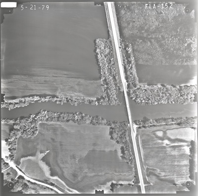
FIA
Date Flown
Spring 5-21-1979
Aerial Survey Project No. (A.S.P. No.)
79S-11
County
Brown, Nicollet
Trunk Highway (T.H.)
4
Location
Bridge 4800 over the Minnesota River S. of Fairfax
Center Latitude
44°26'2.39"N
Center Longitude
94°43'7.04"W
Scale
1''=250'
Flight Height
1500
Work Order No.
44
Agreement No.
59194
State Project No.
0802-25
Lens Serial Number
98183
Focal Length
152.465 mm
Physical Format
Black and White Physical Aerial Photograph
Dimensions
9 x 9
Item Type
Still Image
Collection Name
Minnesota Department of Transportation District 7 Air Photo Collection, 1957-2006
Contributing Organization
Dr. Mary T. Dooley Map Library, Memorial Library, Minnesota State University, Mankato, P.O. Box 8419, Mankato, MN 56002-8419
Contact Information
Dr. Mary T. Dooley Map Library, Memorial Library, Minnesota State University, Mankato, P.O. Box 8419, Mankato, MN 56002-8419
Creative Commons License

This work is licensed under a Creative Commons Attribution-NonCommercial 4.0 International License
Scanning Center
Dr. Mary T. Dooley Map Library, Memorial Library, Minnesota State University, Mankato, P.O. Box 8419, Mankato, MN 56002-8419
Object File Name
MnDOT_1979_79S-11_FIA-152.tif
Date Digital
2022-09-26
Item Digital Format
Image/tiff
Master File Format
Image/tiff
Master File Size
92156232
Master File Bit Depth
24
Master File Resolution
800 dpi
Master File Width
7467
Master File Height
7417
Master File Hardware
Epson Expression 10000XL
Master File Software
VueScan
Master File System
Windows 10
Master File Checksum
44e75e8f85bde73dd3e4af44fd2c62ae
Keywords
mndot, air photos, aerial photography, 1979, minnesota river, wetland

