

Preview
Flight Code
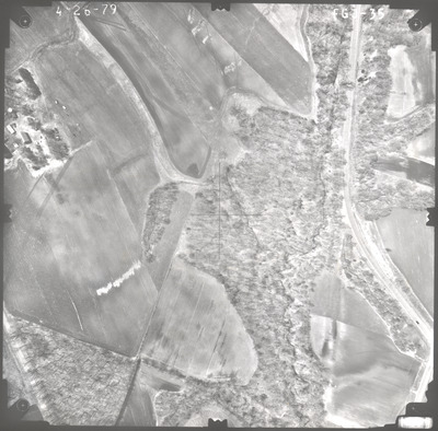
FGJ
Date Flown
Spring 4-26-1979
Aerial Survey Project No. (A.S.P. No.)
79S-14
County
Le Sueur
Trunk Highway (T.H.)
169
Location
From Jct. TH 93 to 3 mi. E.
Center Latitude
44°29'9.79"N
Center Longitude
93°52'20.29"W
Scale
1''=250'
Flight Height
1500
Notes
Note on front includes pencil lines drawn down the center of the photo, both vertical and horizontal, to find the principal point.
Work Order No.
44
Agreement No.
59194
State Project No.
4013
Lens Serial Number
98183
Focal Length
152.46 mm
Physical Format
Black and White Physical Aerial Photograph
Dimensions
9 x 9
Item Type
Still Image
Collection Name
Minnesota Department of Transportation District 7 Air Photo Collection, 1957-2006
Contributing Organization
Dr. Mary T. Dooley Map Library, Memorial Library, Minnesota State University, Mankato, P.O. Box 8419, Mankato, MN 56002-8419
Contact Information
Dr. Mary T. Dooley Map Library, Memorial Library, Minnesota State University, Mankato, P.O. Box 8419, Mankato, MN 56002-8419
Creative Commons License

This work is licensed under a Creative Commons Attribution-NonCommercial 4.0 International License
Scanning Center
Dr. Mary T. Dooley Map Library, Memorial Library, Minnesota State University, Mankato, P.O. Box 8419, Mankato, MN 56002-8419
Object File Name
MnDOT_1979_79S-14_FGJ-35.tif
Date Digital
2022-10-10
Item Digital Format
Image/tiff
Master File Format
Image/tiff
Master File Size
95824130
Master File Bit Depth
24
Master File Resolution
800 dpi
Master File Width
7499
Master File Height
7385
Master File Hardware
Epson Expression 10000XL
Master File Software
VueScan
Master File System
Windows 10
Master File Checksum
ba7fbb1cef417d9553b74ef2c139ef8d
Keywords
mndot, air photos, aerial photography, 1979, stream, field tiling

