

Preview
Flight Code
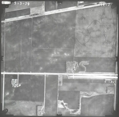
FIF
Date Flown
Spring 5-3-1979
Aerial Survey Project No. (A.S.P. No.)
79S-15
County
Watonwan
Trunk Highway (T.H.)
60
Location
Worthington to Windom and Butterfield to St. James
Center Latitude
43°57'59.53"N
Center Longitude
94°41'22.43"W
State Project No.
8308, 1703, 3204, 5306
Physical Format
Black and White Physical Aerial Photograph
Dimensions
9 x 9
Item Type
Still Image
Collection Name
Minnesota Department of Transportation District 7 Air Photo Collection, 1957-2006
Contributing Organization
Dr. Mary T. Dooley Map Library, Memorial Library, Minnesota State University, Mankato, P.O. Box 8419, Mankato, MN 56002-8419
Contact Information
Dr. Mary T. Dooley Map Library, Memorial Library, Minnesota State University, Mankato, P.O. Box 8419, Mankato, MN 56002-8419
Creative Commons License

This work is licensed under a Creative Commons Attribution-NonCommercial 4.0 International License
Scanning Center
Dr. Mary T. Dooley Map Library, Memorial Library, Minnesota State University, Mankato, P.O. Box 8419, Mankato, MN 56002-8419
Object File Name
MnDOT_1979_79S-15_FIF-7.tif
Date Digital
2022-10-10
Item Digital Format
Image/tiff
Master File Format
Image/tiff
Master File Size
88949600
Master File Bit Depth
24
Master File Resolution
800 dpi
Master File Width
7520
Master File Height
7406
Master File Hardware
Epson Expression 10000XL
Master File Software
VueScan
Master File System
Windows 10
Master File Checksum
acfac3f9e328e2643a229c0bfeac91dc
Keywords
mndot, air photos, aerial photography, 1979, stream, field tiling, railroad, road construction

