

Preview
Flight Code
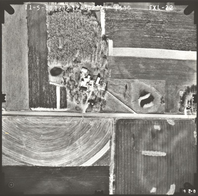
FXL
Date Flown
Fall 11-5-1980
Aerial Survey Project No. (A.S.P. No.)
80F-26
County
Waseca
Trunk Highway (T.H.)
13
Location
North to South Limits of Waseca
Center Latitude
44° 6'9.47"N
Center Longitude
93°30'47.36"W
Scale
1''=250'
Flight Height
1500
Work Order No.
9
Agreement No.
60056
State Project No.
8103-26
Lens Serial Number
124302
Focal Length
152.963 mm
Physical Format
Black and White Physical Aerial Photograph
Dimensions
9 x 9
Item Type
Still Image
Collection Name
Minnesota Department of Transportation District 7 Air Photo Collection, 1957-2006
Contributing Organization
Dr. Mary T. Dooley Map Library, Memorial Library, Minnesota State University, Mankato, P.O. Box 8419, Mankato, MN 56002-8419
Contact Information
Dr. Mary T. Dooley Map Library, Memorial Library, Minnesota State University, Mankato, P.O. Box 8419, Mankato, MN 56002-8419
Creative Commons License

This work is licensed under a Creative Commons Attribution-NonCommercial 4.0 International License
Scanning Center
Dr. Mary T. Dooley Map Library, Memorial Library, Minnesota State University, Mankato, P.O. Box 8419, Mankato, MN 56002-8419
Object File Name
MnDOT_1980_80F-26_FXL-22.tif
Date Digital
2022-10-31
Item Digital Format
Image/tiff
Master File Format
Image/tiff
Master File Size
99125516
Master File Bit Depth
24
Master File Resolution
800 dpi
Master File Width
7496
Master File Height
7393
Master File Hardware
Epson Expression 10000XL
Master File Software
VueScan
Master File System
Windows 10
Master File Checksum
db88ffaa1f5458621697ac5a9afe857f
Keywords
mndot, air photos, aerial photography, 1980, pond, marsh, field tiling

