

Preview
Flight Code
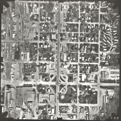
FUY
Date Flown
Spring 4-28-1980
Aerial Survey Project No. (A.S.P. No.)
80S-82
County
Faribault
Trunk Highway (T.H.)
169
Location
From Jct. TH 169 in Blue Earth to 1 mi. S.
Center Latitude
43°38'19.86"N
Center Longitude
94° 5'26.43"W
Scale
1''=250'
Flight Height
1500
Work Order No.
60
Agreement No.
59680
State Project No.
2207
Lens Serial Number
124302
Focal Length
152.96 mm
Physical Format
Black and White Physical Aerial Photograph
Dimensions
9 x 9
Item Type
Still Image
Collection Name
Minnesota Department of Transportation District 7 Air Photo Collection, 1957-2006
Contributing Organization
Dr. Mary T. Dooley Map Library, Memorial Library, Minnesota State University, Mankato, P.O. Box 8419, Mankato, MN 56002-8419
Contact Information
Dr. Mary T. Dooley Map Library, Memorial Library, Minnesota State University, Mankato, P.O. Box 8419, Mankato, MN 56002-8419
Creative Commons License

This work is licensed under a Creative Commons Attribution-NonCommercial 4.0 International License
Scanning Center
Dr. Mary T. Dooley Map Library, Memorial Library, Minnesota State University, Mankato, P.O. Box 8419, Mankato, MN 56002-8419
Object File Name
MnDOT_1980_80S-82_FUY-10.tif
Date Digital
2022-11-30
Item Digital Format
Image/tiff
Master File Format
Image/tiff
Master File Size
106126406
Master File Bit Depth
24
Master File Resolution
800 dpi
Master File Width
7368
Master File Height
7363
Master File Hardware
Epson Expression 10000XL
Master File Software
VueScan
Master File System
Windows 10
Master File Checksum
007fae5452ea41660784ee5038d7cc8f
Keywords
mndot, air photos, aerial photography, 1980, blue earth, railroad, grain elevator

