

Preview
Flight Code
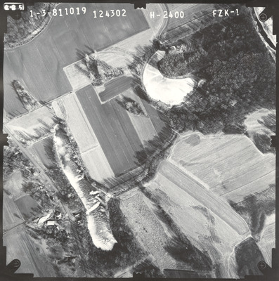
FZK
Date Flown
Winter 1-3-1981
Aerial Survey Project No. (A.S.P. No.)
80F-54
County
Le Sueur, Sibley
Trunk Highway (T.H.)
169
Location
[Vicinity of Le Sueur]
Center Latitude
44°30'40.93"N
Center Longitude
93°53'47.98"W
Scale
1’’=400’
Flight Height
2400
State Project No.
7211
Lens Serial Number
124302
Physical Format
Black and White Physical Aerial Photograph
Dimensions
9 x 9
Item Type
Still Image
Collection Name
Minnesota Department of Transportation District 7 Air Photo Collection, 1957-2006
Contributing Organization
Dr. Mary T. Dooley Map Library, Memorial Library, Minnesota State University, Mankato, P.O. Box 8419, Mankato, MN 56002-8419
Contact Information
Dr. Mary T. Dooley Map Library, Memorial Library, Minnesota State University, Mankato, P.O. Box 8419, Mankato, MN 56002-8419
Creative Commons License

This work is licensed under a Creative Commons Attribution-NonCommercial 4.0 International License
Scanning Center
Dr. Mary T. Dooley Map Library, Memorial Library, Minnesota State University, Mankato, P.O. Box 8419, Mankato, MN 56002-8419
Object File Name
MnDOT_1981_80F-54_FZK-1.tif
Date Digital
2022-11-28
Item Digital Format
Image/tiff
Master File Format
Image/tiff
Master File Size
116533410
Master File Bit Depth
24
Master File Resolution
800 dpi
Master File Width
7384
Master File Height
7438
Master File Hardware
Epson Expression 10000XL
Master File Software
VueScan
Master File System
Windows 10
Master File Checksum
4ae527e67705b08a266ac3de03e57ae5
Keywords
mndot, air photos, aerial photography, 1981, minnesota river, pond, stream, wetland

