

Preview
Flight Code
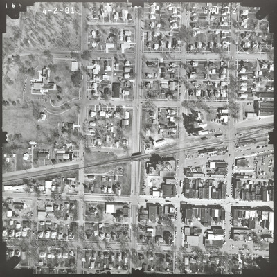
GAU
Date Flown
Spring 4-2-1981
Aerial Survey Project No. (A.S.P. No.)
81S-29
County
Brown
Trunk Highway (T.H.)
4
Location
Jct. TH 14 to N. Corporate Limits in Sleepy Eye
Center Latitude
44°17'54.36"N
Center Longitude
94°43'32.26"W
Scale
1''=250'
Flight Height
1500
Work Order No.
49
Agreement No.
60056
State Project No.
0802
Focal Length
153.115 mm
Physical Format
Black and White Physical Aerial Photograph
Dimensions
9 x 9
Item Type
Still Image
Collection Name
Minnesota Department of Transportation District 7 Air Photo Collection, 1957-2006
Contributing Organization
Dr. Mary T. Dooley Map Library, Memorial Library, Minnesota State University, Mankato, P.O. Box 8419, Mankato, MN 56002-8419
Contact Information
Dr. Mary T. Dooley Map Library, Memorial Library, Minnesota State University, Mankato, P.O. Box 8419, Mankato, MN 56002-8419
Creative Commons License

This work is licensed under a Creative Commons Attribution-NonCommercial 4.0 International License
Scanning Center
Dr. Mary T. Dooley Map Library, Memorial Library, Minnesota State University, Mankato, P.O. Box 8419, Mankato, MN 56002-8419
Object File Name
MnDOT_1981_81S-29_GAU-12.tif
Date Digital
2023-01-13
Item Digital Format
Image/tiff
Master File Format
Image/tiff
Master File Size
109022486
Master File Bit Depth
24
Master File Resolution
800 dpi
Master File Width
7400
Master File Height
7395
Master File Hardware
Epson Expression 10000XL
Master File Software
VueScan
Master File System
Windows 10
Master File Checksum
71fab251d65b5c0e18534013cef5fdd9
Keywords
mndot, air photos, aerial photography, 1981, sleepy eye, railroad, grain elevator

