

Preview
Flight Code
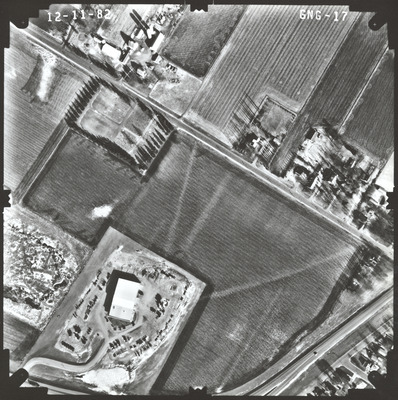
GNG
Date Flown
Fall 12-11-1982
Aerial Survey Project No. (A.S.P. No.)
82F-39
County
Nobles
Trunk Highway (T.H.)
59
Location
Jct. CSAH 35 in Worthington
Center Latitude
43°37'21.09"N
Center Longitude
95°34'29.69"W
Scale
1''=250'
Flight Height
1500
Work Order No.
11
Agreement No.
61066
State Project No.
5305
Lens Serial Number
118991
Focal Length
153.12 mm
Physical Format
Black and White Physical Aerial Photograph
Dimensions
9 x 9
Item Type
Still Image
Collection Name
Minnesota Department of Transportation District 7 Air Photo Collection, 1957-2006
Contributing Organization
Dr. Mary T. Dooley Map Library, Memorial Library, Minnesota State University, Mankato, P.O. Box 8419, Mankato, MN 56002-8419
Contact Information
Dr. Mary T. Dooley Map Library, Memorial Library, Minnesota State University, Mankato, P.O. Box 8419, Mankato, MN 56002-8419
Creative Commons License

This work is licensed under a Creative Commons Attribution-NonCommercial 4.0 International License
Scanning Center
Dr. Mary T. Dooley Map Library, Memorial Library, Minnesota State University, Mankato, P.O. Box 8419, Mankato, MN 56002-8419
Object File Name
MnDOT_1982_82F-39_GNG-17.tif
Date Digital
2023-01-23
Item Digital Format
Image/tiff
Master File Format
Image/tiff
Master File Size
123494878
Master File Bit Depth
24
Master File Resolution
800 dpi
Master File Width
7392
Master File Height
7427
Master File Hardware
Epson Expression 10000XL
Master File Software
VueScan
Master File System
Windows 10
Master File Checksum
2a0bd3575e0fec50a13c89c49e2c404b
Keywords
mndot, air photos, aerial photography, 1981, worthington, field tiling, marsh, saint marys cemetery

