

Preview
Flight Code
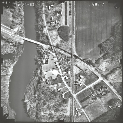
GHS
Date Flown
Spring 4-22-1982
Aerial Survey Project No. (A.S.P. No.)
82S-20
County
Le Sueur, Nicollet
Trunk Highway (T.H.)
22
Location
Bridges 4770, 4846 and 3749 between St. Peter and Kasota
Center Latitude
44°18'20.14"N
Center Longitude
93°57'32.49"W
Scale
1''=250'
Flight Height
1500
Work Order No.
32
Agreement No.
60576
State Project No.
4012-19
Lens Serial Number
118991
Focal Length
153.12 mm
Physical Format
Black and White Physical Aerial Photograph
Dimensions
9 x 9
Item Type
Still Image
Collection Name
Minnesota Department of Transportation District 7 Air Photo Collection, 1957-2006
Contributing Organization
Dr. Mary T. Dooley Map Library, Memorial Library, Minnesota State University, Mankato, P.O. Box 8419, Mankato, MN 56002-8419
Contact Information
Dr. Mary T. Dooley Map Library, Memorial Library, Minnesota State University, Mankato, P.O. Box 8419, Mankato, MN 56002-8419
Creative Commons License

This work is licensed under a Creative Commons Attribution-NonCommercial 4.0 International License
Scanning Center
Dr. Mary T. Dooley Map Library, Memorial Library, Minnesota State University, Mankato, P.O. Box 8419, Mankato, MN 56002-8419
Object File Name
MnDOT_1982_82S-20_GHS-7.tif
Date Digital
2023-01-30
Item Digital Format
Image/tiff
Master File Format
Image/tiff
Master File Size
114193364
Master File Bit Depth
24
Master File Resolution
800 dpi
Master File Width
7360
Master File Height
7395
Master File Hardware
Epson Expression 10000XL
Master File Software
VueScan
Master File System
Windows 10
Master File Checksum
5a9cd7f8e57f6b7d6d850e70df6761c2
Keywords
mndot, air photos, aerial photography, 1982, minnesota river, stream, railroad, junkyard, wetland

