

Preview
Flight Code
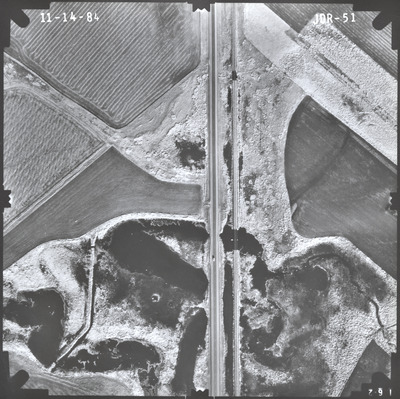
JDR
Date Flown
Fall 11-14-1984
Aerial Survey Project No. (A.S.P. No.)
84F-40
County
Jackson
Trunk Highway (T.H.)
60
Location
Bridge 5573 over Jack Creek, 2 mi. S.W. of Heron Lake
Center Latitude
43°46'58.45"N
Center Longitude
95°20'31.32"W
Scale
1''=250'
Flight Height
1500
Work Order No.
23
Agreement No.
62239
State Project No.
3204-37
Focal Length
153.12 mm
Physical Format
Black and White Physical Aerial Photograph
Dimensions
9 x 9
Item Type
Still Image
Collection Name
Minnesota Department of Transportation District 7 Air Photo Collection, 1957-2006
Contributing Organization
Dr. Mary T. Dooley Map Library, Memorial Library, Minnesota State University, Mankato, P.O. Box 8419, Mankato, MN 56002-8419
Contact Information
Dr. Mary T. Dooley Map Library, Memorial Library, Minnesota State University, Mankato, P.O. Box 8419, Mankato, MN 56002-8419
Creative Commons License

This work is licensed under a Creative Commons Attribution-NonCommercial 4.0 International License
Scanning Center
Dr. Mary T. Dooley Map Library, Memorial Library, Minnesota State University, Mankato, P.O. Box 8419, Mankato, MN 56002-8419
Object File Name
MnDOT_1984_84F-40_JDR-51.tif
Date Digital
2023-02-24
Item Digital Format
Image/tiff
Master File Format
Image/tiff
Master File Size
116010754
Master File Bit Depth
24
Master File Resolution
800 dpi
Master File Width
7368
Master File Height
7347
Master File Hardware
Epson Expression 10000XL
Master File Software
VueScan
Master File System
Windows 10
Master File Checksum
3ce7a4c5a9db5b6231ecd6b52b678d4a
Keywords
mndot, air photos, aerial photography, 1984, stream, marsh, railroad

