

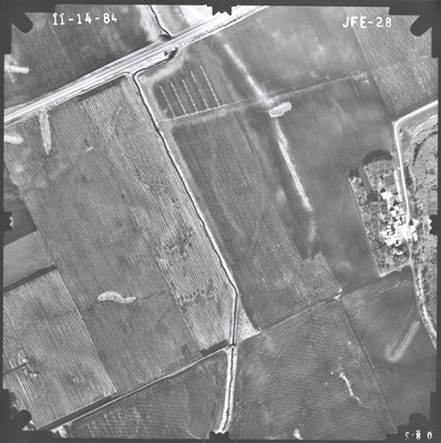
Preview
Flight Code
JFE
Date Flown
Fall 11-14-1984
Aerial Survey Project No. (A.S.P. No.)
84F-42
County
Cottonwood
Trunk Highway (T.H.)
30
Location
County Ditch #42, 3 mi. E. of Westbrook
Center Latitude
44° 1'51.82"N
Center Longitude
95°22'13.17"W
Scale
1’’=400’
Flight Height
2400
Work Order No.
23
Agreement No.
62239
State Project No.
1701
Focal Length
153.12 mm
Physical Format
Black and White Physical Aerial Photograph
Dimensions
9 x 9
Item Type
Still Image
Collection Name
Minnesota Department of Transportation District 7 Air Photo Collection, 1957-2006
Contributing Organization
Dr. Mary T. Dooley Map Library, Memorial Library, Minnesota State University, Mankato, P.O. Box 8419, Mankato, MN 56002-8419
Contact Information
Dr. Mary T. Dooley Map Library, Memorial Library, Minnesota State University, Mankato, P.O. Box 8419, Mankato, MN 56002-8419
Creative Commons License

This work is licensed under a Creative Commons Attribution-NonCommercial 4.0 International License
Scanning Center
Dr. Mary T. Dooley Map Library, Memorial Library, Minnesota State University, Mankato, P.O. Box 8419, Mankato, MN 56002-8419
Object File Name
MnDOT_1984_84F-42_JFE-28.tif
Date Digital
2023-02-27
Item Digital Format
Image/tiff
Master File Format
Image/tiff
Master File Size
115784254
Master File Bit Depth
24
Master File Resolution
800 dpi
Master File Width
7368
Master File Height
7402
Master File Hardware
Epson Expression 10000XL
Master File Software
VueScan
Master File System
Windows 10
Master File Checksum
4a2de4175d8a4a7e72d91d25b55c6250
Keywords
mndot, air photos, aerial photography, 1984, clear lake, ditch, field tiling

