

Preview
Flight Code
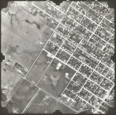
JBH
Date Flown
Spring 5-14-1984
Aerial Survey Project No. (A.S.P. No.)
84S-65
County
Faribault
Trunk Highway (T.H.)
169
Location
Blue Earth to West Jct. TH 60 S.W. of Mankato
Center Latitude
43°45'51.75"N
Center Longitude
94°10'30.94"W
Scale
1''=500'
Flight Height
3000
Work Order No.
33
Agreement No.
61635
State Project No.
2208, 8303
Lens Serial Number
UAG 245
Focal Length
152.228 mm
Physical Format
Black and White Physical Aerial Photograph
Dimensions
9 x 9
Item Type
Still Image
Collection Name
Minnesota Department of Transportation District 7 Air Photo Collection, 1957-2006
Contributing Organization
Dr. Mary T. Dooley Map Library, Memorial Library, Minnesota State University, Mankato, P.O. Box 8419, Mankato, MN 56002-8419
Contact Information
Dr. Mary T. Dooley Map Library, Memorial Library, Minnesota State University, Mankato, P.O. Box 8419, Mankato, MN 56002-8419
Creative Commons License

This work is licensed under a Creative Commons Attribution-NonCommercial 4.0 International License
Scanning Center
Dr. Mary T. Dooley Map Library, Memorial Library, Minnesota State University, Mankato, P.O. Box 8419, Mankato, MN 56002-8419
Object File Name
MnDOT_1984_84S-65_JBH-137.tif
Date Digital
2023-04-07
Item Digital Format
Image/tiff
Master File Format
Image/tiff
Master File Size
93531396
Master File Bit Depth
24
Master File Resolution
800 dpi
Master File Width
7464
Master File Height
7369
Master File Hardware
Epson Expression 10000XL
Master File Software
VueScan
Master File System
Windows 10
Master File Checksum
abcdbc8962e15d1839043da6ab46e27c
Keywords
mndot, air photos, aerial photography, 1984, winnebago, railroad, field tiling

