

Preview
Flight Code
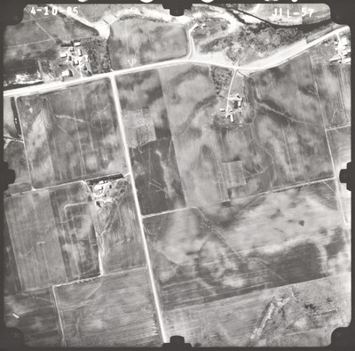
JIL
Date Flown
Spring 4-10-1985
Aerial Survey Project No. (A.S.P. No.)
85S-20
County
Blue Earth
Trunk Highway (T.H.)
14
Location
Between Jct. TH 22 at Mankato and 1 mi. W. of the E. Blue Earth Co. Line
Center Latitude
44° 9'14.42"N
Center Longitude
93°46'56.41"W
Scale
1''=500'
Flight Height
3000
Work Order No.
46
Agreement No.
62239
State Project No.
0702-87
Camera
Camera No. 577
Lens Serial Number
UAG 245
Focal Length
152.228 mm
Physical Format
Black and White Physical Aerial Photograph
Dimensions
9 x 9
Item Type
Still Image
Collection Name
Minnesota Department of Transportation District 7 Air Photo Collection, 1957-2006
Contributing Organization
Dr. Mary T. Dooley Map Library, Memorial Library, Minnesota State University, Mankato, P.O. Box 8419, Mankato, MN 56002-8419
Contact Information
Dr. Mary T. Dooley Map Library, Memorial Library, Minnesota State University, Mankato, P.O. Box 8419, Mankato, MN 56002-8419
Creative Commons License

This work is licensed under a Creative Commons Attribution-NonCommercial 4.0 International License
Scanning Center
Dr. Mary T. Dooley Map Library, Memorial Library, Minnesota State University, Mankato, P.O. Box 8419, Mankato, MN 56002-8419
Object File Name
MnDOT_1985_85S-20_JIL-57.tif
Date Digital
2023-03-24
Item Digital Format
Image/tiff
Master File Format
Image/tiff
Master File Size
90998014
Master File Bit Depth
24
Master File Resolution
800 dpi
Master File Width
7464
Master File Height
7369
Master File Hardware
Epson Expression 12000XL
Master File Software
VueScan
Master File System
Windows 10
Master File Checksum
92b2df3abce6049c3566a9254be8668e
Keywords
mndot, air photos, aerial photography, 1985, ditch, marsh, field tiling

