

Preview
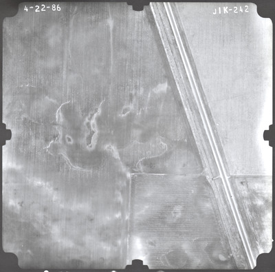
Flight Code
JIK
Date Flown
Spring 4-22-1986
Aerial Survey Project No. (A.S.P. No.)
86S-93
County
Cottonwood
Trunk Highway (T.H.)
60
Location
Cottonwood Co. Line to E. of Mountain Lake
Center Latitude
43°54'35.54"N
Center Longitude
95° 1'29.74"W
Scale
1''=250'
Flight Height
1500
State Project No.
1703-45, 1703-48
Lens Serial Number
UAG 245
Physical Format
Black and White Physical Aerial Photograph
Dimensions
9 x 9
Item Type
Still Image
Collection Name
Minnesota Department of Transportation District 7 Air Photo Collection, 1957-2006
Contributing Organization
Dr. Mary T. Dooley Map Library, Memorial Library, Minnesota State University, Mankato, P.O. Box 8419, Mankato, MN 56002-8419
Contact Information
Dr. Mary T. Dooley Map Library, Memorial Library, Minnesota State University, Mankato, P.O. Box 8419, Mankato, MN 56002-8419
Creative Commons License

This work is licensed under a Creative Commons Attribution-NonCommercial 4.0 International License
Scanning Center
Dr. Mary T. Dooley Map Library, Memorial Library, Minnesota State University, Mankato, P.O. Box 8419, Mankato, MN 56002-8419
Object File Name
MnDOT_1986_86S-93_JIK-242.tif
Date Digital
2023-07-05
Item Digital Format
Image/tiff
Master File Format
Image/tiff
Master File Size
95934530
Master File Bit Depth
24
Master File Resolution
800 dpi
Master File Width
7456
Master File Height
7355
Master File Hardware
Epson Expression 12000XL
Master File Software
VueScan
Master File System
Windows 10
Master File Checksum
be7bfa3178c46fe79a9ba2970bb15d7c
Keywords
mndot, air photos, aerial photography, 1986, railroad, field tiling

