• Home
  • Search
  • Browse Collections
  • My Account
  • About
  • DC Network Digital Commons Network™
Skip to main content
Cornerstone: A Collection of Scholarly and Creative Works for Minnesota State University, Mankato
  • Home
  • About
  • FAQ
  • My Account

Home > MAPS > MAPS-MNDOT7-AIR-PHOTOS > MNDOT7-1987-87F-66

1987 Aerial Survey Project No. 87F-66 (KHU)

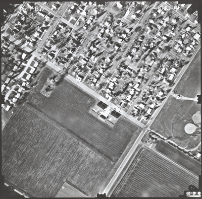
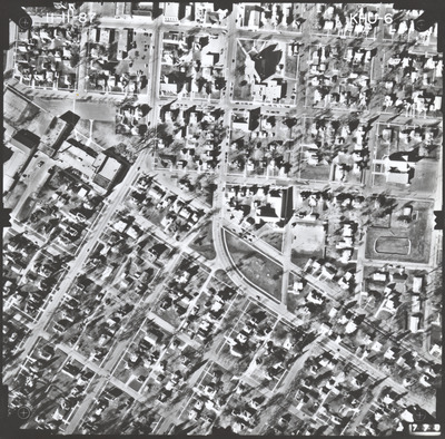
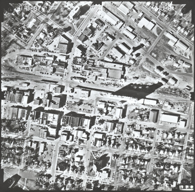
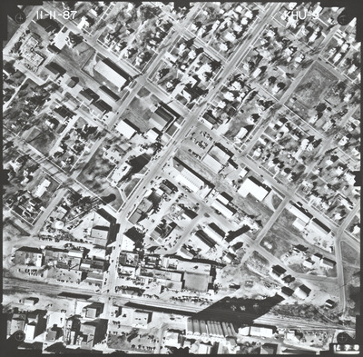
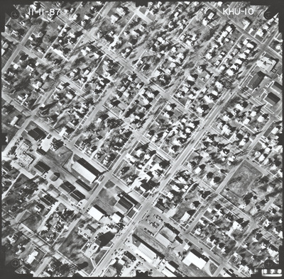
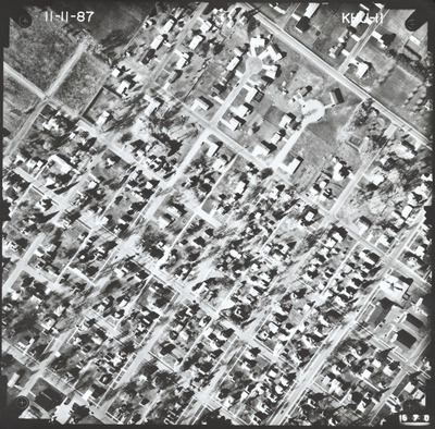
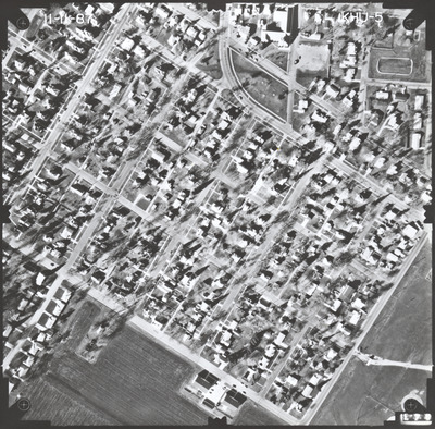
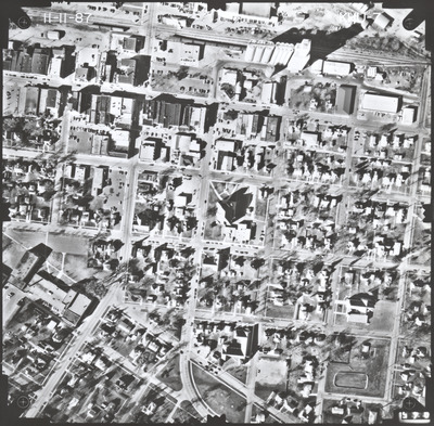
Aerial survey project no. 87F-66 was flown on November 11, 1987. These photos are a verbal scale of 1"=250'. The flight line provides coverage for highway 4 in St. James from Armstrong Boulevard to 3rd Street North.

Printing is not supported at the primary Gallery Thumbnail page. Please first navigate to a specific Image before printing.

Follow

Switch View to List View Slideshow
 
  • KHU-04 by Mark Hurd Aerial Surveys, Inc. Minneapolis, Minnesota

    KHU-04

  • KHU-05 by Mark Hurd Aerial Surveys, Inc. Minneapolis, Minnesota

    KHU-05

  • KHU-06 by Mark Hurd Aerial Surveys, Inc. Minneapolis, Minnesota

    KHU-06

  • KHU-07 by Mark Hurd Aerial Surveys, Inc. Minneapolis, Minnesota

    KHU-07

  • KHU-08 by Mark Hurd Aerial Surveys, Inc. Minneapolis, Minnesota

    KHU-08

  • KHU-09 by Mark Hurd Aerial Surveys, Inc. Minneapolis, Minnesota

    KHU-09

  • KHU-10 by Mark Hurd Aerial Surveys, Inc. Minneapolis, Minnesota

    KHU-10

  • KHU-11 by Mark Hurd Aerial Surveys, Inc. Minneapolis, Minnesota

    KHU-11


Search

Advanced Search

  • Notify me via email or RSS

Author Corner

  • All Authors
  • Author FAQ
  • Submit Research

University Resources

  • Digital Exhibits
  • ARCH: University Archives Digital Collections
  • Library Services
  • Minnesota State University, Mankato
  • Contact Us
Minnesota State University Mankato Minnesota State
 
Elsevier - Digital Commons

Home | About | FAQ | My Account | Accessibility Statement

Privacy Copyright