

Preview
Flight Code
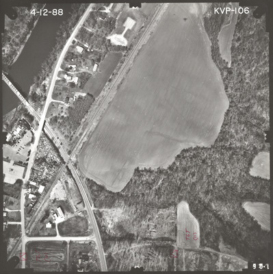
KVP
Date Flown
Spring 4-12-1988
Aerial Survey Project No. (A.S.P. No.)
88S-11
County
Le Sueur, Nicollet
Trunk Highway (T.H.)
22
Location
Jct. TH 14 in Mankato to Jct. TH 169 in St. Peter
Center Latitude
44°18'22.17"N
Center Longitude
93°57'20.16"W
Scale
1''=250'
Flight Height
1500
Notes
Notes on front include "TGT (11)" and a symbol of a triangle inside a square.
Work Order No.
35
Agreement No.
64236
State Project No.
0714, 4012
Lens Serial Number
118969
Focal Length
152.951 mm
Physical Format
Black and White Physical Aerial Photograph
Dimensions
9 x 9
Item Type
Still Image
Collection Name
Minnesota Department of Transportation District 7 Air Photo Collection, 1957-2006
Contributing Organization
Dr. Mary T. Dooley Map Library, Memorial Library, Minnesota State University, Mankato, P.O. Box 8419, Mankato, MN 56002-8419
Contact Information
Dr. Mary T. Dooley Map Library, Memorial Library, Minnesota State University, Mankato, P.O. Box 8419, Mankato, MN 56002-8419
Creative Commons License

This work is licensed under a Creative Commons Attribution-NonCommercial 4.0 International License
Scanning Center
Dr. Mary T. Dooley Map Library, Memorial Library, Minnesota State University, Mankato, P.O. Box 8419, Mankato, MN 56002-8419
Object File Name
MnDOT_1988_88S-11_KVP-106a.tif
Date Digital
2022-11-14
Item Digital Format
Image/tiff
Master File Format
Image/tiff
Master File Size
120443398
Master File Bit Depth
24
Master File Resolution
800 dpi
Master File Width
7384
Master File Height
7395
Master File Hardware
Epson Expression 10000XL
Master File Software
VueScan
Master File System
Windows 10
Master File Checksum
65e6341e05e600db15c47b2837ee7e06
Keywords
mndot, air photos, aerial photography, 1988, minnesota river, stream, gravel pit, railroad

