

Preview
Date Flown
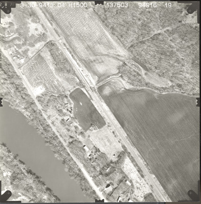
Spring 3-30-1994
Aerial Survey Project No. (A.S.P. No.)
94S-16
County
Le Sueur, Nicollet
Trunk Highway (T.H.)
169
Location
Mankato to St. Peter
Center Latitude
44°18'34.63"N
Center Longitude
93°57'16.96"W
Scale
1''=250'
Flight Height
1500
Work Order No.
52
Agreement No.
69831
State Project No.
5211
Camera
Zeiss RMK-A 15/23 W/FMC
Lens Serial Number
137503
Focal Length
153.72 mm
Physical Format
Black and White Physical Aerial Photograph
Dimensions
9 x 9
Item Type
Still Image
Collection Name
Minnesota Department of Transportation District 7 Air Photo Collection, 1957-2006
Contributing Organization
Dr. Mary T. Dooley Map Library, Memorial Library, Minnesota State University, Mankato, P.O. Box 8419, Mankato, MN 56002-8419
Contact Information
Dr. Mary T. Dooley Map Library, Memorial Library, Minnesota State University, Mankato, P.O. Box 8419, Mankato, MN 56002-8419
Creative Commons License

This work is licensed under a Creative Commons Attribution-NonCommercial 4.0 International License
Scanning Center
Dr. Mary T. Dooley Map Library, Memorial Library, Minnesota State University, Mankato, P.O. Box 8419, Mankato, MN 56002-8419
Object File Name
MnDOT_1994_94S-16-19.tif
Date Digital
2022-11-16
Item Digital Format
Image/tiff
Master File Format
Image/tiff
Master File Size
114518270
Master File Bit Depth
24
Master File Resolution
800 dpi
Master File Width
7208
Master File Height
7332
Master File Hardware
Epson Expression 10000XL
Master File Software
VueScan
Master File System
Windows 10
Master File Checksum
6d119263712f30919753480dd7a31515
Keywords
mndot, air photos, aerial photography, 1994, minnesota river, railroad

