

Preview
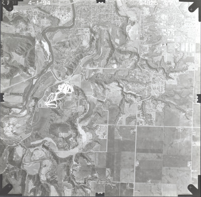
Date Flown
Spring 4-1-1994
Aerial Survey Project No. (A.S.P. No.)
94S-25
County
Blue Earth, Nicollet
Location
Mankato Area
Center Latitude
44° 7'46.04"N
Center Longitude
94° 1'17.43"W
Scale
1’’=2000’
Flight Height
12000
Work Order No.
52
Agreement No.
69831
State Project No.
0700, 4000, 5200
Camera
Zeiss RMK-A 15/23 W/FMC
Lens Serial Number
137503
Focal Length
153.72 mm
Physical Format
Black and White Physical Aerial Photograph
Dimensions
9 x 9
Item Type
Still Image
Collection Name
Minnesota Department of Transportation District 7 Air Photo Collection, 1957-2006
Contributing Organization
Dr. Mary T. Dooley Map Library, Memorial Library, Minnesota State University, Mankato, P.O. Box 8419, Mankato, MN 56002-8419
Contact Information
Dr. Mary T. Dooley Map Library, Memorial Library, Minnesota State University, Mankato, P.O. Box 8419, Mankato, MN 56002-8419
Creative Commons License

This work is licensed under a Creative Commons Attribution-NonCommercial 4.0 International License
Scanning Center
Dr. Mary T. Dooley Map Library, Memorial Library, Minnesota State University, Mankato, P.O. Box 8419, Mankato, MN 56002-8419
Object File Name
MnDOT_1994_94S-25-27.tif
Date Digital
2023-11-03
Item Digital Format
Image/tiff
Master File Format
Image/tiff
Master File Size
92216538
Master File Bit Depth
24
Master File Resolution
800 dpi
Master File Width
7384
Master File Height
7257
Master File Hardware
Epson Expression 12000XL
Master File Software
VueScan
Master File System
Windows 10
Master File Checksum
a776abdc5ea78b7a0ce1a5c25cd5f765
Keywords
mndot, air photos, aerial photography, 1994, le hillier, mankato, skyline, blue earth river, le sueur river, minnesota river, pond, stream, marsh, railroad, field tiling, gravel pit, mankato state university, holberg cemetery, grand view memorial cemetery, woodland hills memorial park cemetery, wetland

