

Preview
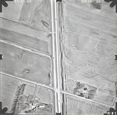
Date Flown
Fall 11-21-1995
Aerial Survey Project No. (A.S.P. No.)
95F-15
County
Jackson
Trunk Highway (T.H.)
60
Location
Wilder to Windom
Center Latitude
43°50'17.21"N
Center Longitude
95° 9'10.18"W
Scale
1''=250'
Flight Height
1500
Work Order No.
50
Agreement No.
72206
State Project No.
1703-58, 3204-54
Camera
Zeiss RMK-A 15/23 W/FMC
Lens Serial Number
137503
Focal Length
153.72 mm
Physical Format
Black and White Physical Aerial Photograph
Dimensions
9 x 9
Item Type
Still Image
Collection Name
Minnesota Department of Transportation District 7 Air Photo Collection, 1957-2006
Contributing Organization
Dr. Mary T. Dooley Map Library, Memorial Library, Minnesota State University, Mankato, P.O. Box 8419, Mankato, MN 56002-8419
Contact Information
Dr. Mary T. Dooley Map Library, Memorial Library, Minnesota State University, Mankato, P.O. Box 8419, Mankato, MN 56002-8419
Creative Commons License

This work is licensed under a Creative Commons Attribution-NonCommercial 4.0 International License
Scanning Center
Dr. Mary T. Dooley Map Library, Memorial Library, Minnesota State University, Mankato, P.O. Box 8419, Mankato, MN 56002-8419
Object File Name
MnDOT_1995_95F-15-22.tif
Date Digital
2023-11-03
Item Digital Format
Image/tiff
Master File Format
Image/tiff
Master File Size
103042374
Master File Bit Depth
24
Master File Resolution
800 dpi
Master File Width
7384
Master File Height
7266
Master File Hardware
Epson Expression 12000XL
Master File Software
VueScan
Master File System
Windows 10
Master File Checksum
33d9b5c00873ff1dfa7d6132ebd33860
Keywords
mndot, air photos, aerial photography, 1995, railroad, field tiling

