

Preview
Date Flown
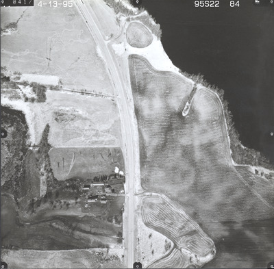
Spring 4-13-1995
Aerial Survey Project No. (A.S.P. No.)
95S-22
County
Le Sueur
Trunk Highway (T.H.)
13
Location
Waseca to Montgomery
Center Latitude
44°16'59.96"N
Center Longitude
93°35'7.78"W
Scale
1''=250'
Flight Height
1500
Work Order No.
20
Agreement No.
72206
State Project No.
4001, 8102
Camera
Zeiss RMK-A 15/23 W/FMC
Lens Serial Number
144134
Focal Length
152.84 mm
Physical Format
Black and White Physical Aerial Photograph
Dimensions
9 x 9
Item Type
Still Image
Collection Name
Minnesota Department of Transportation District 7 Air Photo Collection, 1957-2006
Contributing Organization
Dr. Mary T. Dooley Map Library, Memorial Library, Minnesota State University, Mankato, P.O. Box 8419, Mankato, MN 56002-8419
Contact Information
Dr. Mary T. Dooley Map Library, Memorial Library, Minnesota State University, Mankato, P.O. Box 8419, Mankato, MN 56002-8419
Creative Commons License

This work is licensed under a Creative Commons Attribution-NonCommercial 4.0 International License
Scanning Center
Dr. Mary T. Dooley Map Library, Memorial Library, Minnesota State University, Mankato, P.O. Box 8419, Mankato, MN 56002-8419
Object File Name
MnDOT_1995_95S-22-84.tif
Date Digital
2023-11-04
Item Digital Format
Image/tiff
Master File Format
Image/tiff
Master File Size
93694686
Master File Bit Depth
24
Master File Resolution
800 dpi
Master File Width
7360
Master File Height
7232
Master File Hardware
Epson Expression 12000XL
Master File Software
VueScan
Master File System
Windows 10
Master File Checksum
3820d7c69177260ade22228be22ca521
Keywords
mndot, air photos, aerial photography, 1995, sunfish lake, pond, marsh, field tiling, wetland

