

Preview
Date Flown
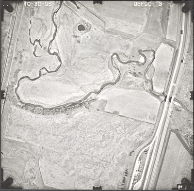
Fall 10-30-1996
Aerial Survey Project No. (A.S.P. No.)
96F-90
County
Nobles
Trunk Highway (T.H.)
I-90
Location
NW of Adrian
Center Latitude
43°38'27.77"N
Center Longitude
95°57'43.14"W
Scale
1’’=400’
Flight Height
2400
Work Order No.
12
Agreement No.
75157
State Project No.
5380
Camera
Zeiss RMK-A 15/23 W/FMC
Lens Serial Number
137503
Focal Length
153.72 mm
Physical Format
Black and White Physical Aerial Photograph
Dimensions
9 x 9
Item Type
Still Image
Collection Name
Minnesota Department of Transportation District 7 Air Photo Collection, 1957-2006
Contributing Organization
Dr. Mary T. Dooley Map Library, Memorial Library, Minnesota State University, Mankato, P.O. Box 8419, Mankato, MN 56002-8419
Contact Information
Dr. Mary T. Dooley Map Library, Memorial Library, Minnesota State University, Mankato, P.O. Box 8419, Mankato, MN 56002-8419
Creative Commons License

This work is licensed under a Creative Commons Attribution-NonCommercial 4.0 International License
Scanning Center
Dr. Mary T. Dooley Map Library, Memorial Library, Minnesota State University, Mankato, P.O. Box 8419, Mankato, MN 56002-8419
Object File Name
MnDOT_1996_96F-90-3.tif
Date Digital
2023-11-14
Item Digital Format
Image/tiff
Master File Format
Image/tiff
Master File Size
100129898
Master File Bit Depth
24
Master File Resolution
800 dpi
Master File Width
7416
Master File Height
7314
Master File Hardware
Epson Expression 12000XL
Master File Software
VueScan
Master File System
Windows 10
Master File Checksum
1a99841d711e509998cc6b7142fc5d78
Keywords
mndot, air photos, aerial photography, 1996, kanaranzi creek, pond, stream, railroad, field tiling, wetland

