

Preview
Date Flown
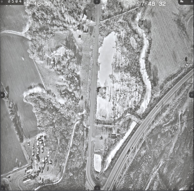
Fall 12-16-1997
Aerial Survey Project No. (A.S.P. No.)
97F-48
County
Sibley
Trunk Highway (T.H.)
169
Location
Le Sueur area
Center Latitude
44°28'46.73"N
Center Longitude
93°55'12.98"W
Scale
1''=250'
Flight Height
1500
Work Order No.
53
Agreement No.
75157
State Project No.
4013-41, 7200
Camera
Zeiss RMK Top 15 W/FMC
Lens Serial Number
143105
Focal Length
152.76 mm
Physical Format
Black and White Physical Aerial Photograph
Dimensions
9 x 9
Item Type
Still Image
Collection Name
Minnesota Department of Transportation District 7 Air Photo Collection, 1957-2006
Contributing Organization
Dr. Mary T. Dooley Map Library, Memorial Library, Minnesota State University, Mankato, P.O. Box 8419, Mankato, MN 56002-8419
Contact Information
Dr. Mary T. Dooley Map Library, Memorial Library, Minnesota State University, Mankato, P.O. Box 8419, Mankato, MN 56002-8419
Creative Commons License

This work is licensed under a Creative Commons Attribution-NonCommercial 4.0 International License
Scanning Center
Dr. Mary T. Dooley Map Library, Memorial Library, Minnesota State University, Mankato, P.O. Box 8419, Mankato, MN 56002-8419
Object File Name
MnDOT_1997_97F-48-32.tif
Date Digital
2023-11-17
Item Digital Format
Image/tiff
Master File Format
Image/tiff
Master File Size
100250640
Master File Bit Depth
24
Master File Resolution
800 dpi
Master File Width
7376
Master File Height
7266
Master File Hardware
Epson Expression 12000XL
Master File Software
VueScan
Master File System
Windows 10
Master File Checksum
b2bdac78d68cc325fbd482ab8eb3a707
Keywords
mndot, air photos, aerial photography, 1997, pond, marsh, field tiling, wetland

