
Preview
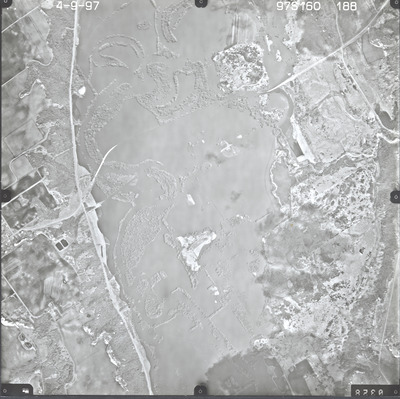
Date Flown
Spring 4-9-1997
Aerial Survey Project No. (A.S.P. No.)
97S-160
County
Redwood, Renville
Location
MN [Minnesota] River from Big Stone to Belle Plaine
Center Latitude
44°30'42.63"N
Center Longitude
94°53'37.94"W
Scale
1''=1320'
Flight Height
7920
Work Order No.
41
Agreement No.
75157
State Project No.
Flood Assessment
Camera
Zeiss RMK-A 15/23 W/FMC
Lens Serial Number
143105
Focal Length
152.76 mm
Physical Format
Black and White Physical Aerial Photograph
Dimensions
9 x 9
Item Type
Still Image
Collection Name
Minnesota Department of Transportation District 7 Air Photo Collection, 1957-2006
Contributing Organization
Dr. Mary T. Dooley Map Library, Memorial Library, Minnesota State University, Mankato, P.O. Box 8419, Mankato, MN 56002-8419
Contact Information
Dr. Mary T. Dooley Map Library, Memorial Library, Minnesota State University, Mankato, P.O. Box 8419, Mankato, MN 56002-8419
Creative Commons License

This work is licensed under a Creative Commons Attribution-NonCommercial 4.0 International License
Scanning Center
Dr. Mary T. Dooley Map Library, Memorial Library, Minnesota State University, Mankato, P.O. Box 8419, Mankato, MN 56002-8419
Object File Name
MnDOT_1997_97S-160-188.tif
Date Digital
2023-11-29
Item Digital Format
Image/tiff
Master File Format
Image/tiff
Master File Size
107316954
Master File Bit Depth
24
Master File Resolution
800 dpi
Master File Width
7288
Master File Height
7276
Master File Hardware
Epson Expression 12000XL
Master File Software
VueScan
Master File System
Windows 10
Master File Checksum
c324a141bc9f31e263b5a5072b719a39
Keywords
mndot, air photos, aerial photography, 1997, franklin, minnesota river, purgatory creek, wabasha creek, pond, stream, marsh, railroad, field tiling, sewage disposal pond, wetland