

Preview
Flight Code
BIP
Date Flown
Summer 7-14-1971
County
Blue Earth, Nicollet
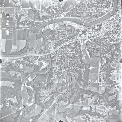
Description
1971 aerial photography of Blue Earth County commissioned by the Agricultural Stabilization and Conservation Service at the U.S. Department of Agriculture.
Center Latitude
44.151937
Center Longitude
-94.026970
Scale
1:20000
Flight Height
13750
Notes
Note on front includes a handwritten "5" to show the photo number "95."
Invitation No.
ASCS-4-71 DC
Item No.
4
Lens Serial Number
808289
Focal Length
209.40 mm
Physical Format
Black and White Physical Aerial Photograph
Dimensions
9 x 9
Item Type
Still Image
Collection Name
Minnesota County Air Photo Collection
Contributing Organization
Dr. Mary T. Dooley Map Library, Memorial Library, Minnesota State University, Mankato, P.O. Box 8419, Mankato, MN 56002-8419
Contact Information
Dr. Mary T. Dooley Map Library, Memorial Library, Minnesota State University, Mankato, P.O. Box 8419, Mankato, MN 56002-8419
Creative Commons License

This work is licensed under a Creative Commons Attribution-NonCommercial 4.0 International License
Scanning Center
Dr. Mary T. Dooley Map Library, Memorial Library, Minnesota State University, Mankato, P.O. Box 8419, Mankato, MN 56002-8419
Object File Name
MnCo_1971_BIP_1MM-095.tif
Date Digital
2026-03-25
Item Digital Format
Image/tiff
Master File Format
Image/tiff
Master File Size
89463550
Master File Bit Depth
24
Master File Resolution
800 dpi
Master File Width
7206
Master File Height
7192
Master File Hardware
Epson Expression 12000XL
Master File Software
VueScan
Master File System
Windows 11
Master File Checksum
d3dcb14baab25a1a9d2ce38f4a3cff7a
Keywords
usda, ascs, air photos, aerial photography, blue earth county, 1971, lehillier, mankato, north mankato, skyline, blue earth river, minnesota river, pond, stream, marsh, railroad, field tiling, grain elevator, gravel pit, mankato state college, grand view memorial cemetery, sibley mound cemetery, wetland

