

Preview
Flight Code
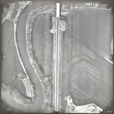
GAT
Date Flown
Spring 4-2-1981
Aerial Survey Project No. (A.S.P. No.)
81S-30
County
Brown, Nicollet
Trunk Highway (T.H.)
14
Location
Proposed River Crossing at New Ulm
Center Latitude
44°17'55.89"N
Center Longitude
94°25'46.37"W
Scale
1''=250'
Flight Height
1500
Work Order No.
49
Agreement No.
60056
State Project No.
5202
Lens Serial Number
118991
Focal Length
152.963 mm
Physical Format
Black and White Physical Aerial Photograph
Dimensions
9 x 9
Item Type
Still Image
Collection Name
Minnesota Department of Transportation District 7 Air Photo Collection, 1957-2006
Contributing Organization
Dr. Mary T. Dooley Map Library, Memorial Library, Minnesota State University, Mankato, P.O. Box 8419, Mankato, MN 56002-8419
Contact Information
Dr. Mary T. Dooley Map Library, Memorial Library, Minnesota State University, Mankato, P.O. Box 8419, Mankato, MN 56002-8419
Creative Commons License

This work is licensed under a Creative Commons Attribution-NonCommercial 4.0 International License
Scanning Center
Dr. Mary T. Dooley Map Library, Memorial Library, Minnesota State University, Mankato, P.O. Box 8419, Mankato, MN 56002-8419
Object File Name
MnDOT_1981_81S-30_GAT-24.tif
Date Digital
2023-01-13
Item Digital Format
Image/tiff
Master File Format
Image/tiff
Master File Size
117100592
Master File Bit Depth
24
Master File Resolution
800 dpi
Master File Width
7400
Master File Height
7406
Master File Hardware
Epson Expression 10000XL
Master File Software
VueScan
Master File System
Windows 10
Master File Checksum
6705284fb666e0752f4db0209def959b
Keywords
mndot, air photos, aerial photography, 1981, minnesota river, wetland

