

Preview
Flight Code
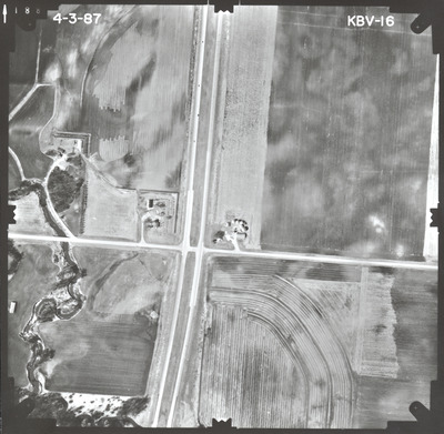
KBV
Date Flown
Spring 4-3-1987
Aerial Survey Project No. (A.S.P. No.)
87S-33
County
Watonwan
Trunk Highway (T.H.)
60
Location
From CSAH 12 E. of St. James to Jct. TH 15
Center Latitude
43°58'44.19"N
Center Longitude
94°31'49.13"W
Scale
1’’=400’
Flight Height
2400
Work Order No.
44
Agreement No.
63683
State Project No.
8309-39
Lens Serial Number
118991
Focal Length
153.124 mm
Physical Format
Black and White Physical Aerial Photograph
Dimensions
9 x 9
Item Type
Still Image
Collection Name
Minnesota Department of Transportation District 7 Air Photo Collection, 1957-2006
Contributing Organization
Dr. Mary T. Dooley Map Library, Memorial Library, Minnesota State University, Mankato, P.O. Box 8419, Mankato, MN 56002-8419
Contact Information
Dr. Mary T. Dooley Map Library, Memorial Library, Minnesota State University, Mankato, P.O. Box 8419, Mankato, MN 56002-8419
Creative Commons License

This work is licensed under a Creative Commons Attribution-NonCommercial 4.0 International License
Scanning Center
Dr. Mary T. Dooley Map Library, Memorial Library, Minnesota State University, Mankato, P.O. Box 8419, Mankato, MN 56002-8419
Object File Name
MnDOT_1987_87S-33_KBV-16.tif
Date Digital
2023-07-25
Item Digital Format
Image/tiff
Master File Format
Image/tiff
Master File Size
98685588
Master File Bit Depth
24
Master File Resolution
800 dpi
Master File Width
7624
Master File Height
7459
Master File Hardware
Epson Expression 10000XL
Master File Software
VueScan
Master File System
Windows 10
Master File Checksum
8f5f4a65f107db009284fc3c00a06386
Keywords
mndot, air photos, aerial photography, 1987, south fork watonwan river, field tiling, wetland

